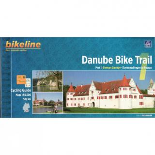
Bikeline Cycling Guide cykloturistický sprievodca DANUBE BIKE TRAIL 1 - Esterbauer
PART 1: German Danube - Donaueschingen to Passau
GPS-Tracks
spiral bounding
local maps
height profiles
distance 580 km
152 pages
Charakteristika cyklosprievodcu vydavateľom:
The Danube is not merely one of Europe’s great rivers. At 2,888 kilometers from the source of the Breg and 2,845 kilometers from the confluence of the Breg, Brigach and Danube Spring in Donaueschingen, it is the second longest river in Europe; only the Volga (3,534 kilometers) is longer. It is one thousand kilometers longer than the Rhine, and collects water from a catchment basin that is more than four times as large. The Danube flows through or along the borders of ten nations and has long served as one of the most important transportation links between Europe and Asia. Let us follow the Danube from its modest beginnings in southwestern Germany. Deep in the Black Forest, a few kilometers northwest of Furtwangen, the map notes the source of the Danube. If one follows this tiny stream, it reaches the village of Zindelstein, where it acquires a name: the Breg. It keeps this name as far as Donaueschingen, where it meets a second stream, the Brigach, coming from near Triberg to the north. The two streams merge and acquire a new name, the Danube (Donau in German), which it keeps in various forms and languages all the way to the Black Sea.The Danube is unique in Europe for another reason. As the only river in the continent which measures its kilometers from the mouth towards the source, it “ends” in Donaueschingen. In the 19th century, the residents of Donaueschingen erected an impressive basin around a karst-spring in the city’s Schlosspark and declared it the river’s source. This basin is decorated with a marble sculpture that shows the Danube as a small girl next to a woman who represents the Baar, the rolling hill country that surrounds the city. The Baar points the girl eastward towards the sea. The site does little to suggest a great river, however, as the waters from this purported “source” immediately disappear between metal bars into underwater pipes leading to the nearby Brigach. Downstream from Donaueschingen, the Danube has barely begun its meandering march eastward when it reaches the foothills of the Swabian Alb near the town of Immendingen. This plateau is formed of porous limestone and provides the conditions for a remarkable and curious phenomenon called the Danube Sink. With a spooky gurgling and hissing, the river’s waters disappear into the ground and flow beneath the surface until they reemerge 12 kilometers further East. The banks of the Danube offer a rich diversity of natural and cultural sights. In Mühlheim, for instance, the medieval Enzberger castle and curious St. Gallus church look down on the river. Rocky promontories rise above the valley floor and provide habitat for many unusual birds and plants. Ancient strongholds and castles keep guard over the river from strategic points along the valley. There is the massive Beuron Archabbey, for instance, built by the Austrian architect Franz Beer, or nearby Wildenstein Castle where the hard-drinking Count Gottfried von Zimmer sought refuge from the Black Plague in 1528 and thus also avoided the peasant uprisings that followed. Werenwag Castle is where the minstrel Hugo von Werenwag wrote his verse around 1260. Nearby Kreenheinstetten was the birthplace in 1644 of Johann Ulrich Megerle, who later became famous in Vienna as the eloquent preacher Abraham a Sancta Clara. Each of these castles offers interesting views of the valley that the Danube has carved into the jurassic rock. The valley widens near Inzigkofen before the river reaches Sigmaringen, where a proud castle, the one-time residence of the Hohenzollerns, rises above a confusion of ancient roofs. From Sigmaringen the river continues in leisurely loops before emerging from the Swabian Alb at Ulm. On its way to the Ingolstadt basin your cycling tour passes through a number of particularly scenic areas, including the Leibi nature preserve near
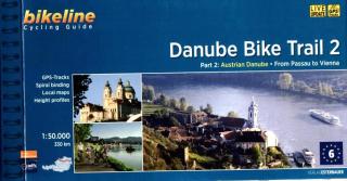
Bikeline Cycling Guide cykloturistický sprievodca DANUBE BIKE TRAIL 2 - Esterbauer PART 2: Austrian Danube - From Passau to Vienna GPS-Tracks spiral bounding local maps height profiles distance 320 km 160 pages Charakteristika cyklosprievodcu vydavateľom: In the last decade the Danube bike trail has emerged as Europe’s most important long-distance bicycle touring route. Its popularity is due primarily to the Danube’s natural beauty and the wealth of cultural and historical sites that line its banks. B
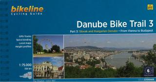
Bikeline Cycling Guide cykloturistický sprievodca DANUBE BIKE TRAIL 3 - Esterbauer PART 3: Slovak and Hungarian Danube - From Vienna to Budapest GPS-Tracks spiral bounding local maps height profiles distance 334 km Charakteristika cyklosprievodcu vydavateľom: Danube Bike Trail 3 The Danube Bike Trail from Passau to Vienna is the most travelled long-distance cycling route in Europe. Every year, thousands of cyclists explore the varied scenery which the route through Austria has to offer. For most cyclist
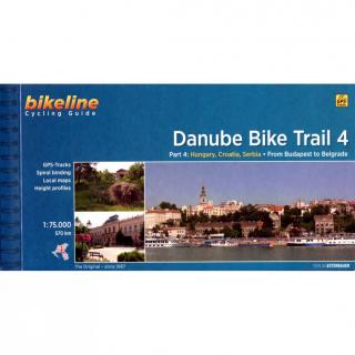
Bikeline Cycling Guide cykloturistický sprievodca DANUBE BIKE TRAIL 4 - Esterbauer Part 4: From Budapest to Belgrade On the Beautiful Blue Danube GPS-Tracks spiral bounding local maps height profiles distance 570 km 120 pages Charakteristika cyklosprievodcu vydavateľom: The fourth part of our Danube Bike Trail series begins in the Hungarian capital Budapest and ends in the Serbian capital Belgrade.With a total length of 2,845 kilometers, the Danube is Europe’s second longest river (after the Volga wi
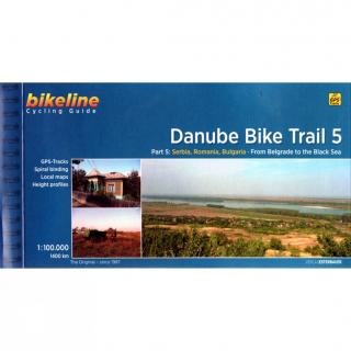
Bikeline Cycling Guide cykloturistický sprievodca DANUBE BIKE TRAIL 5 - Esterbauer Part 5: From Belgrade to the Black Sea GPS-Tracks spiral bounding local maps height profiles distance 1400 km 200 pages Charakteristika cyklosprievodcu vydavateľom: The fifth part of the Danube Bike Trail begins in Belgrade and ends in Romania on the Black Sea.With a total length of 2,845 kilometres, the Danube is Europe’s second longest river (after the Volga with 3,534 kilometres), and the only one on which kilometres
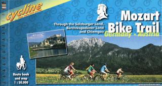
Bikeline cykloturistický sprievodca MOZART BIKE TRAIL - Esterbauer Through the Salzburger Land, Berchtesgadener Land and Chiemgau Stadtpläne Übernachtungsverzeichnis Höhenprofil Spiralbindung 120 Seiten Länge: 430km Charakteristika cyklosprievodcu vydavateľom: Salzkammergut, Chiemgau and Tyrol. These three regions along the Austrian-German border dazzle with stunning landscapes, verdant Alpine pastures, meadows filled with wildflowers, crisp clean air and refreshing lakes. The lively city of Salzburg, h
Cykloturistická mapa v mierke 1:125tis, vydavateľa Freytag & Berndt Zobrazuje trasu PASSAU - VIEDEN - BRATISLAVA Cykloturistická mapa 1 : 125 000, cykloatlas špirálové viazanie. Kompaktný rozmer, vhodný pre cyklistické tašky. Obsahuje: cyklistické trasy v danej oblasti pre cestnú a horskú cyklistiku s uvedením výškových profilov popísaná obtiažnosť, vzdialenosť cyklotrás, doba jazdy dôležité adresy a kontakty zaujímavé tipy na zájazdy s popismi trás - v jazyku nemeckom a anglickom + farebné fotog
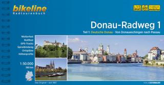
Bikeline Radtourenbuch cykloturistický sprievodca DONAU RADWEG TEIL 1 - Esterbauer Teil 1: Deutsche Donau. Von Donaueschingen nach Passau GPS-Tracks Spiralbindung Stadtpläne Übernachtungsverzeichnis Höhenprofil, Länge 590 km 160 Seiten Donau-Radweg 1 Die Landstriche entlang der deutschen Donau gehören zu den schönsten Flusslandschaften des Kontinents. Neben zahlreichen unberührten Augebieten locken auch viele kulturelle Sehenswürdigkeiten, vor allem der Barock hat seine pompösen Spuren hinterlassen. Da
Collins German Dictionary Grammar is an uptodate dictionary and a userfriendly grammar guide in one handy volume. Colour headwords, cultural notes and an easytouse, revised grammar section make this the ideal book for intermediate learners. Collins German Dictionary Grammar is designed for all intermediate learners of German, whether at school, at home, or for business. 90,000 references and 118,000 translations will help those learning German take their language skills to the next level. This edition
A portable, uptotheminute German dictionary. This latest edition comes with all the new words in German and English plus handy links to German verb tables, making it the perfect choice for travelers, students and business people. Features include All the latest words in German and English Links to verb tables Ideal companion to GCSE German Userfriendly Phrasefinder supplement for travellers, including a handy menureader section Clear, colour layout, useful examples, language and cultural notes All th
- Rund 590 km liegen zwischen dem Start des Donauradweges im Schwarzwald (Donaueschingen) und Passau in Niederbayern. Der Donauradweg ist einer der meist befahrenen Radwege Deutschlands. Ist ja auch kein Wunder, bei diesem Variantenreichtum. - Die Donau durchstreift unterschiedliche Landschaften und somit auch die Radler. Es geht durch den Schwarzwald und die Schwäbische Alb, man radelt durch Wälder in Bayern und den wildromantischen Donaudurchbruch bei Kehlheim am Fuße der Fränkischen Alb. Im engen Ober
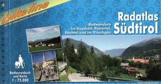
Bikeline cykloturistický sprievodca RADATLAS SÜDTIROL - Esterbauer Radwandern im Eisacktal, Pustertal, Etschtal und im Vinschgau Übernachtungsverzeichnis Spiralbindung 180 Seiten
Lasst uns die Worte finden! is a language game designed to teach basic German words from six thematic categories. Details AGE RANGE Children from 8 years of age, adolescents, adults. LANGUAGE LEVEL Beginner A1 CONTENT 9 cardboard dice, 4,5cm x 4,5cm each manual in German covering methodical remarks. 48 key words. Educational goals learning basic German nouns developing conversation skills
Die Wörter in Aktion is a language game designed to practice sentence building using basic German words and expressions. Details AGE RANGE Children from 7 years of age, adolescents, adults. LANGUAGE LEVEL Beginner A1 CONTENT 6 cardboard dice, 4,5cm x 4,5cm each manual in German covering methodical remarks. 180 key words and expressions. Educational goals learning basic German nouns developing conversation skills
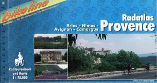
Bikeline cykloturistický sprievodca RADATLAS PROVENCE - Esterbauer Arles, Nîmes, Avignon, Camargue Stadtpläne Übernachtungsverzeichnis Höhenprofil Spiralbindung Länge: 448 km Charakteristika cyklosprievodcu vydavateľom: Provence – The name alone sounds inviting to every traveller. Let yourself be enchanted by ancient towns and historic monasteries, by the rich scent from fields of lavender, the charm of tiny villages and French joie de vivre. A refreshing plunge into the Mediterranean is just one of the
The set contains 200 picture cards containing 600 basic words. It is perfect for people who start their adventure with the German language. However, for more advanced students we can set more difficult tasks, eg. saying a sentence in the tense we want to practise (or asking a question to the next player) with a word from the card. The set consists of 400 nouns, 100 verbs, and 100 adjectives.